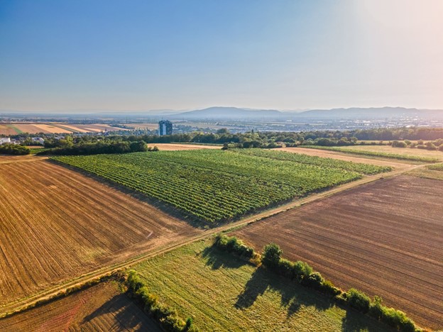
Vegetation indices enable precise assessments across vast areas by converting raw imagery into actionable insights. Advances in drone and satellite technology enable more efficient and detailed imagery. Combining close-up views from drones with the broad coverage of satellites creates accurate vegetation indices essential for agriculture, environmental monitoring, and resource management.
Understanding Vegetation Indices
Vegetation indices are mathematical values calculated by transforming data from multiple spectral bands derived from remote sensing. They highlight particular properties and features of vegetation, helping to distinguish them from other objects. Key vegetation indices include:
- NDVI (Normalised Difference Vegetation Index): Measures the difference between near-infrared light, which vegetation reflects, and red light, which vegetation absorbs. It is a widely used index.
- EVI (Enhanced Vegetation Index): Improves NDVI by minimising atmospheric effects and soil background, providing more accurate readings.
- SAVI (Soil Adjusted Vegetation Index): Adjusts for soil brightness, making it useful in areas with sparse vegetation.
Calculating vegetation indices involves extracting spectral bands from satellite or drone imagery, such as red and near-infrared. An index formula, like NDVI, is then applied to generate a readable map of vegetation health or density.
Data Acquisition and Preparation
Acquiring satellite imagery involves selecting data based on image resolution and coverage area. High-resolution imagery is suitable for detailed studies, whereas low-resolution imagery with broader coverage is better for large-scale monitoring.
Capturing high-resolution images with drones requires careful planning and equipment selection. Flight schedules should be optimised for ideal lighting and minimal atmospheric interference. Drones, like satellites, can be fitted with multispectral or hyperspectral sensors, depending on the required detail and budget.
Preprocessing imagery is vital for accurate analysis, including radiometric correction to adjust for sensor discrepancies, atmospheric correction, and georeferencing to align images with geographic coordinates.
Applying Vegetation Indices
Various software tools and libraries are available to simplify the calculation of vegetation indices. QGIS and ArcGIS offer built-in functions for applying index formulas to remote sensing data. Python libraries like Rasterio and GDAL provide advanced data manipulation options for custom processing.
Vegetation indices are vital across various fields, such as:
- Agriculture: Monitoring crop health and optimising irrigation and fertilisation.
- Forestry: Managing forest health, detecting deforestation, and assessing fire risk.
- Environment: Tracking land cover changes and supporting conservation efforts.
Vegetation indices detect anomalies like disease, water stress, or deforestation, enabling early detection and timely intervention for better crop management and resource conservation.
Image Analysis Techniques
Interpreting vegetation indices involves understanding how colour representations in images indicate vegetation health. For example, NDVI maps typically show healthy vegetation in green and stressed areas in yellow to red.
Various classification techniques are employed to categorise vegetation types and conditions based on these indices:
- Supervised Classification: Trains a model with labelled data for predefined classes, offering high accuracy but requiring extensive training data.
- Unsupervised Classification: Groups pixels based on spectral similarity without predefined classes, useful for exploratory analysis but less accurate.
- Machine Learning Classification: Uses algorithms to learn from data, handling complex patterns but requiring computational resources.
Temporal Analysis
Temporal analysis is crucial for monitoring vegetation changes over time. Examining vegetation indices at different time points makes it possible to track crop development, identify patterns, and assess the impact of weather and management practices.
Change detection techniques identify and quantify shifts in vegetation by comparing sequential data from satellite and drone imagery, revealing issues like stress and disease. Seasonal and phenological analysis uses temporal data to track yearly variations and critical events like flowering and harvesting.
Integration of Vegetation Indices with GIS and Remote Sensing
Overlaying vegetation indices data in GIS creates detailed spatial maps, enabling the visualisation and analysis of vegetation patterns. This integration supports data-driven decisions in agriculture and environmental management.
Advanced remote sensing tools, including LiDAR and hyperspectral imaging, provide deeper insights into vegetation analysis. LiDAR offers precise topographic information, hyperspectral imaging captures a wide range of spectral data, and machine learning algorithms improve data interpretation and pattern recognition.
Workflow automation streamlines processes for vegetation index calculation and analysis, reducing manual effort and speeding up data processing. This efficiency allows for more effective analysis of vegetation data.
The Road Ahead
Analysing drone and satellite imagery with vegetation indices has revolutionised vegetation monitoring by offering detailed insights into plant health and environmental changes. Integration of hyperspectral imaging has further enhanced the accuracy and detail of these indices.
Innovations from companies like Pixxel with advanced hyperspectral imaging satellites provide high-resolution images, precise spatial accuracy, and frequent updates. Future advancements in this technology promise even greater precision and real-time analysis, leading to more effective and sustainable agricultural and environmental practices.
Contact Pixxel’s sales team today to learn how Pixxel’s solutions can benefit your agricultural organisation.
FAQs
1.What are vegetation indices?
Vegetation indices are mathematical values derived from spectral bands of remote sensing data that highlight specific properties of vegetation, such as health and density.
2.How do drones and satellites enhance vegetation analysis?
Drones provide high-resolution close-up imagery, while satellites offer broad coverage. Combining both allows for detailed and extensive vegetation analysis.
3.What is NDVI, and how is it used?
NDVI (Normalised Difference Vegetation Index) measures the difference between near-infrared and red light to assess vegetation health. It’s widely used for monitoring plant health and land cover.
4.How is hyperspectral imaging different from multispectral imaging?
Hyperspectral imaging captures data across hundreds of narrow spectral bands, providing detailed information compared to multispectral imaging, which uses fewer, broader bands.
5.What are some typical applications of vegetation indices?
Vegetation indices are used to monitor crop health, manage forests, assess water quality, study soil composition, and detect changes in urban environments.

Author: Pixxel Space
Pixxel is a space data company, building a constellation of hyperspectral earth imaging satellites and the analytical tools to mine insights from that data. The constellation is designed to provide global coverage every 24 hours, with the aim of detecting, monitoring and predicting global phenomena.


